Te Atatū Bus Interchange serves Te Atatū Peninsula and Te Atatū South, and is a major transfer point for local routes including the frequent Route 13 to Henderson, and Te Atatū Peninsula. The interchange sits close to the Harbourview-Orangihina walkway along the Waitematā Harbour.
Walking & Cycling
Two excellent off-road paths right by the interchange — a harbourside loop and a striking new boardwalk through the mangroves.
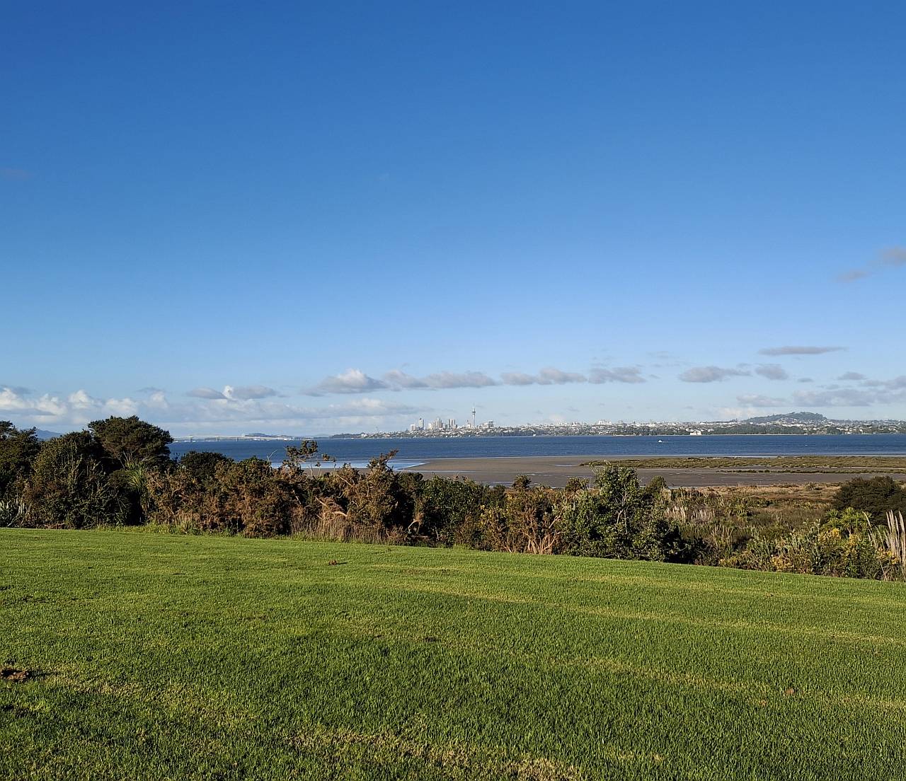
Harbourview-Orangihina Reserve
"Such a beautiful park reserve — I love coming here for walks in the early mornings to catch the sunrise and again in the evenings to enjoy the sunset. It's peaceful, grounding, and a real gem." A large coastal reserve on the Waitematā Harbour, now a full loop path on smooth concrete that allows bicycles, with "breathtaking views of the Harbour Bridge, Auckland SkyCity and the CBD." For a longer outing, continue along the peninsula for an 8km walk to the north end of Te Atatū Peninsula, then catch Route 13 back from Wharf Road.
Loop path · Smooth concrete, bike-friendly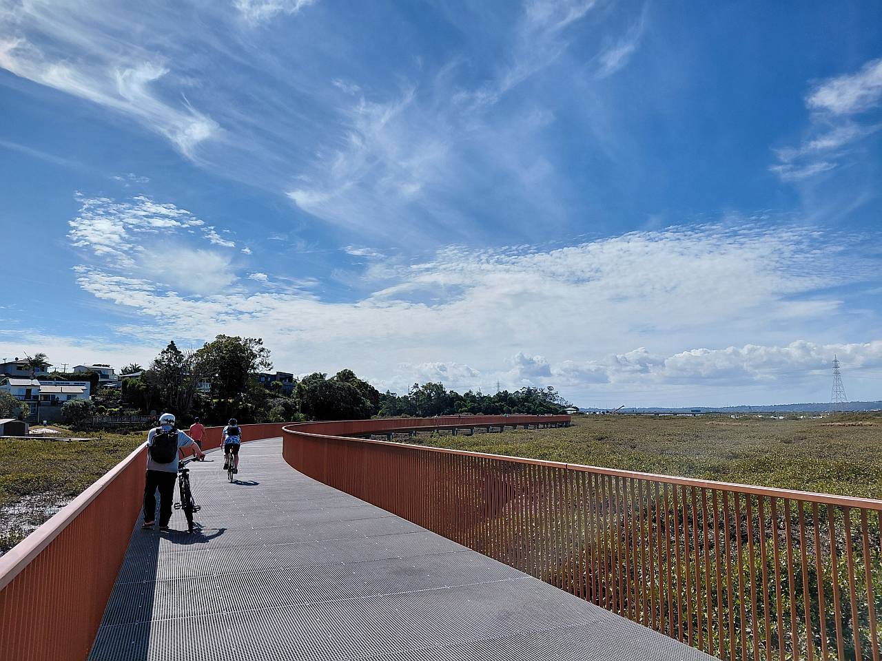
A striking 1.3km boardwalk and concrete shared path following the Whau River through dense mangroves — the first completed section of what will eventually be a 12km off-road route connecting the Waitematā Harbour at Te Atatū to the Manukau Harbour at Green Bay. From the interchange, follow the cycleway past the Te Atatū off-ramp — around 5 minutes downhill — to reach the path down to Robert Road, roughly 2km away. "The wide boardwalk hovers above the mangroves of the Whau River estuary — thrillingly beautiful, snaking along the water while kōtare flit and dive around it." Unlike the motorway-side Northwestern Cycleway, this path is far from roads, with the distant hum of traffic and the city skyline beyond only reminding you how immersed in nature you are. Dogs on leads welcome.
Dogs on leads welcomeNorthwest Busway Services
Motorway services connecting through to Lincoln Interchange, Westgate and the City Centre.
| Route | Serves | Frequency |
|---|---|---|
| WX1 | Westgate → City Centre via Lincoln Interchange & Te Atatū Interchange, no stops between Te Atatū & Karangahape Road | Frequent |
| 11T | Westgate → City Centre via Westgate Drive & Triangle Road, Lincoln Interchange, Te Atatū Interchange, Pt Chevalier, Western Springs & Grey Lynn | Frequent |
| 11W | Westgate → City Centre via Massey West, Lincoln Interchange, Te Atatū Interchange, Pt Chevalier, Western Springs & Grey Lynn | Frequent |
Local Routes
Local routes feed into the interchange, connecting Te Atatū Peninsula and Te Atatū South to the busway services above.
| Route | Serves | Frequency |
|---|---|---|
| 13 | Te Atatū Peninsula Loop ↔ Henderson via Te Atatū Interchange & Te Atatū Road | Frequent |
| 135 | Henderson ↔ Te Atatū Peninsula (Totara Road) via Edmonton Road, Flanshaw Road & Royal View Road | Connector |
| 149 | Rānui ↔ New Lynn via Swanson Road, Universal Drive, Lincoln Interchange, Te Atatū Interchange & Rosebank Road · Weekdays only | Connector |
🚌 Route 13 is the key connection at Te Atatū — running every 8 minutes at peak and every 10 minutes during the day, it links the interchange directly to Henderson for train connections, and loops around Te Atatū Peninsula.
⚠️ Ratings and hours can change. Always check venues' own websites or Google Maps for current hours. Bus route information sourced from Auckland Transport — always check at.govt.nz for current timetables.